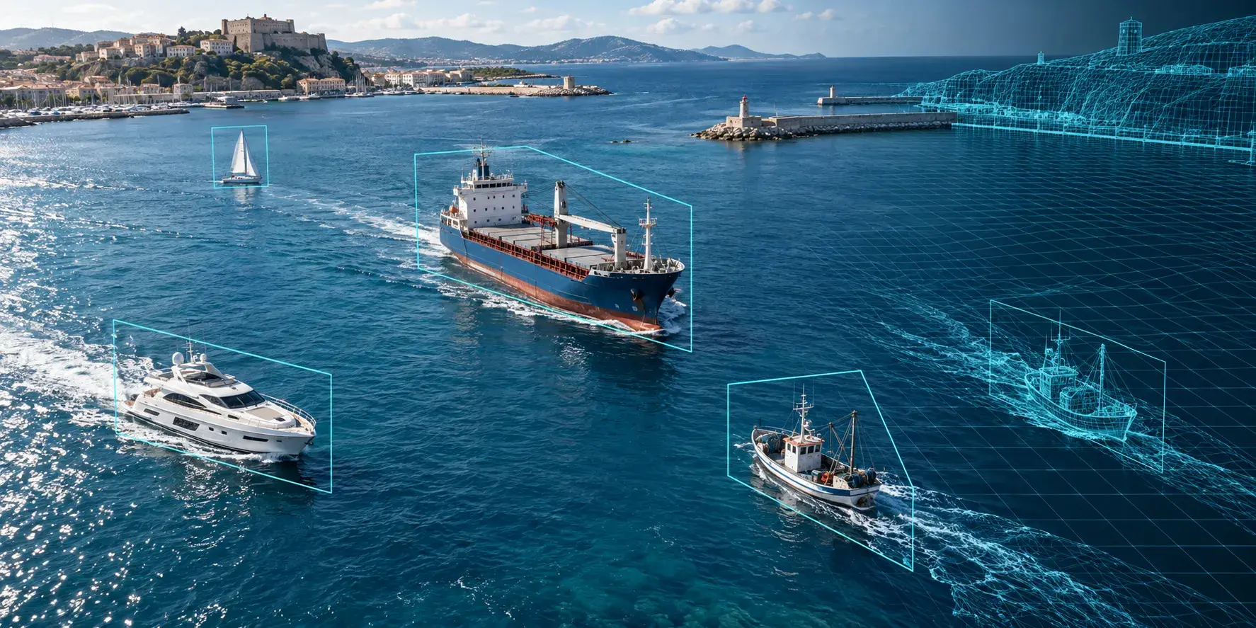
A vessel detection model has to recognize thousands of hull shapes, sizes, and liveries across sea states that range from glassy calm to breaking whitecaps, and it has to do it with a training set that real-world footage almost never covers evenly. Fishing boats outnumber naval vessels in most real datasets by a wide margin, storms are rare in a camera's field of view precisely when they matter most, and a port's own camera feed only ever shows the vessels that actually pass through it. Synthetic maritime imagery exists to fill in what real capture leaves out. Here is how it actually gets built, what published results show, and where it gets used.
Why Vessel Detection Data Is Hard to Collect
Maritime surveillance covers an enormous range of object classes, from small recreational craft to bulk carriers hundreds of meters long, and a model that only sees common vessel types in calm, well-lit conditions fails exactly when it matters, during a storm, at night, or when a vessel is trying not to be seen. Real footage collection is also geographically and seasonally biased: a camera mounted at one port captures that port's traffic patterns, not the full diversity of vessel types and behaviors a detection system needs to generalize across.
Labeling adds another constraint. Distinguishing a fishing trawler from a similarly sized pleasure craft, or identifying a vessel that has gone dark by disabling its transponder, requires domain expertise that slows manual annotation down considerably. None of this is unique to maritime data, but the combination of class diversity, rare-condition scarcity, and annotation difficulty makes it a harder problem than most other computer vision domains.
Scale compounds the issue further. A model deployed across an entire coastline or shipping lane needs to hold up across dozens of camera positions and viewing angles, not just the handful a real data collection campaign happened to cover. Waiting for a real dataset broad enough to span that variation, while also including the storms, fog, and dark-vessel behavior that matter most operationally, can take years longer than most programs have.
How Synthetic Maritime Imagery Gets Generated
Vessel 3D models and hull diversity
The starting point is a library of 3D vessel models covering the hull types, sizes, and configurations the model needs to recognize, cargo ships, fishing trawlers, speedboats, naval craft, each with enough geometric and material variation to avoid the model latching onto one specific model's silhouette as a proxy for the whole class. Academic datasets built this way, like the UnityShip synthetic dataset, have used dozens of distinct ship models across multiple categories rendered in varied virtual scenes to cover exactly this kind of diversity.
Water, weather, and sea state simulation
This is the part that actually separates convincing maritime synthetic data from unconvincing renders. Water is dynamic, reflective, and constantly changing texture with wind and current, and a vessel's wake, the trailing wave pattern behind a moving hull, carries real information a detection or classification model can learn from if it is rendered correctly and becomes a source of false confidence if it is not. Weather and lighting randomization, sun angle, cloud cover, fog, rain, glare, matters more here than in most synthetic data domains because sea state changes the entire visual character of a scene, not just the lighting on a fixed background.
Sensor matching across optical, IR, and SAR
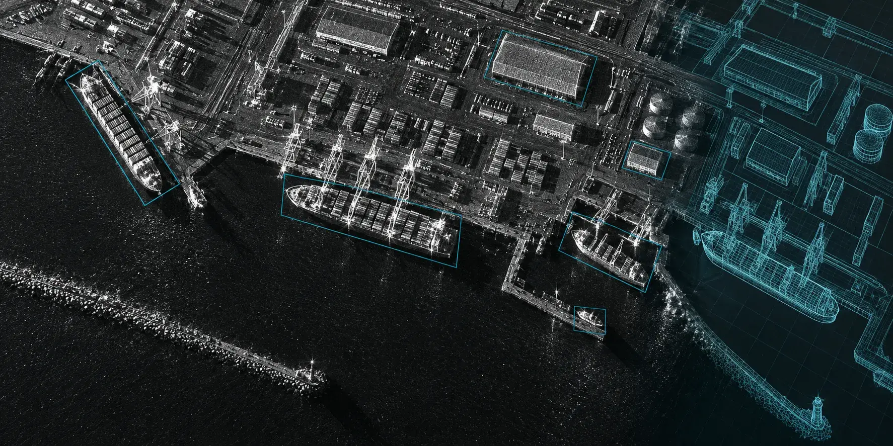
Maritime detection systems run across several sensor types depending on the platform, daylight optical cameras on patrol vessels, infrared for night operation, and synthetic aperture radar for satellite-based, all-weather coverage. A synthetic pipeline built only for one sensor type will not transfer its labels or its domain-randomization logic to another. Teams working across sensors, particularly the optical-to-SAR crossover common in maritime surveillance, need separate but coordinated simulation approaches for each modality rather than assuming one renderer covers every case.
What the Published Evidence Actually Shows
Independent results in this space are still limited, which makes the ones that exist worth reading closely rather than taking on faith. Bifrost AI published a maritime detection case study showing a YOLOv11n model trained on 2,000 synthetic images reaching over 70% F1 on a real test sequence, then improving to 82% F1 after adding 500 more targeted synthetic images, a reported 12 percentage point gain from synthetic data alone with no additional real-world collection. Research on adverse-condition maritime data, such as the SafeSea approach to generating low-probability weather scenarios, has focused specifically on the storm and low-visibility conditions that real datasets underrepresent by nature.1 The pattern across published work is consistent: synthetic data helps most on the conditions and vessel classes that are genuinely rare in real footage, and results are reported against real test sets rather than synthetic validation alone, which is the detail worth checking in any vendor's claims.
Where Synthetic Vessel Data Gets Used
Port and coastal surveillance
Automated systems monitoring port approaches and coastal waters need to track vessel traffic continuously and flag anomalies, which requires training data covering the full range of legitimate traffic patterns so that genuine anomalies stand out rather than getting lost among edge cases the model has never seen. That means covering ordinary tugboat and ferry traffic just as thoroughly as the rare event a system is ultimately built to catch, since a model that only knows what anomalies look like has no baseline to compare them against.
Illegal and dark fishing detection
Vessels engaged in illegal fishing often disable their AIS transponder specifically to avoid tracking, which means the detection has to happen visually or via radar rather than through the position-reporting systems most maritime monitoring otherwise relies on. Synthetic data lets teams generate the specific evasive behaviors and vessel types associated with this problem without waiting for enough real dark-vessel encounters to accumulate.
Search and rescue
Finding a small vessel or a person in open water depends on a model that generalizes well to conditions rescue operations actually happen in, poor visibility, rough seas, low light, which are exactly the conditions real training footage is thinnest on. Synthetic scenes built to represent these specific adverse conditions directly address that gap.
Evaluating a Synthetic Maritime Data Approach
Water and wake rendering quality is the first thing worth scrutinizing, since it is the hardest part of the pipeline to get right and the easiest for a vendor to gloss over with a few polished still images. Ask whether sea state and wake are modeled dynamically or just layered in as a static texture. Sensor coverage matters just as much: confirm the pipeline actually supports the sensor the model will deploy on, optical, IR, or SAR, rather than assuming a renderer built for one transfers cleanly to another. And as with any synthetic data claim, real-world validation against an actual test set is the step that separates a credible result from a marketing number. A vendor reporting performance only against synthetic holdout data has not actually answered the question that matters.
Frequently Asked Questions
What is synthetic maritime data used for?
It is used to train and improve computer vision models for vessel detection, classification, and tracking, particularly for rare vessel types, adverse weather conditions, and unusual behaviors like dark fishing that real-world footage covers unevenly or not at all.
How realistic does synthetic water and wake simulation need to be?
It needs to be realistic enough that the model learns genuine visual cues rather than artifacts of the renderer. Wake patterns and sea surface behavior carry real information for detection and classification tasks, so static or oversimplified water rendering can teach a model the wrong signals.
Can synthetic vessel data be combined with SAR-based detection?
Yes, and for satellite-based maritime surveillance it often needs to be, since SAR sensors work day or night and through cloud cover while optical sensors do not. The two require separate simulation approaches, since SAR imagery and optical imagery have fundamentally different physical origins.
How much synthetic data is actually needed to train a vessel detection model?
Published results vary, but one documented case reached a working baseline with around 2,000 synthetic images and improved further with a few hundred additional targeted images. The right volume depends more on how well the synthetic scenes cover the model's failure modes than on raw image count.
Does synthetic maritime data need real-world validation?
Yes. Every credible published result in this space reports performance against a real test set rather than a synthetic validation set alone, and that comparison is the step that confirms the synthetic data actually transfers to real deployment conditions.