Real synthetic aperture radar imagery is one of the hardest data types to get your hands on. Most of it sits behind government and defense programs, the scenes that matter most, a specific vessel type in a specific sea state, a specific vehicle at a specific look angle, are rare almost by definition, and a single labeled dataset can take months to assemble. Synthetic SAR imagery exists to close that gap. This guide covers how it actually gets generated, what it can honestly promise, and where teams put it to work.
Why Real SAR Data Is Hard to Get
Unlike an optical camera, a SAR sensor builds an image by sending radar pulses toward the ground and reconstructing a scene from the reflections, which means collecting it requires a satellite pass or an aircraft with a radar payload rather than a photographer with a camera. Programs like the European Space Agency's Sentinel-1 mission made C-band SAR imagery far more accessible than it used to be, but revisit schedules are fixed, coverage of any specific target is a matter of luck, and higher-resolution or specialized-band data still runs through defense and intelligence channels most teams never see.
That scarcity compounds for computer vision training specifically. A detection model needs hundreds or thousands of labeled examples across viewing angles, target orientations, and background clutter conditions, and SAR images are notoriously hard to label by eye since a ship, a vehicle, or a building often shows up as little more than a bright blob against noise. Waiting for enough real, correctly labeled examples to accumulate naturally can take years for anything beyond the most common target classes.
How Synthetic SAR Imagery Actually Gets Generated
Physics-based scattering and raytracing models
The core of a SAR simulator is a model of how radar waves scatter off a 3D object and its surroundings. Two approaches dominate: scattering-center models, which represent a target as a set of discrete reflection points with known radar cross-section, and raytracing engines, which trace simulated radar rays against a full 3D scene the way a game engine traces light. Raytracing tends to scale better to complex, cluttered environments, a coastline, a port, a mixed urban scene, while scattering-center models can be faster for isolated target recognition tasks. Recent published work has combined both approaches in the same pipeline specifically to cover their complementary weaknesses.
Speckle noise and sensor-specific parameters
A raw radar return does not look like a clean image. SAR data carries speckle, a grainy interference pattern that comes from the coherent nature of radar backscatter, and any simulator that skips it produces imagery a detection model will not generalize from. A credible pipeline also has to match the sensor it is targeting: frequency band, resolution, incidence angle, and polarization all change what a given target looks like, so a simulator tuned for one satellite's parameters will not automatically transfer to another's.
Automatic labeling and scenario control
Because the simulation starts from a known 3D scene and known target geometry, every generated image comes with exact ground truth, bounding boxes, target class, orientation, without a human ever looking at a radar blob and guessing. That also means scenario parameters, look angle, range resolution, background clutter, target spacing, can be swept systematically to cover combinations a real collection campaign would never happen to capture.
What Synthetic SAR Data Can and Cannot Promise
This is where vendor marketing tends to overreach. Terms like "physically accurate SAR simulation" or "sensor-perfect SAR data" show up often in this space, but no simulator fully replicates the physical complexity of real radar backscatter, particularly for scenes with mixed materials, weather effects, or unusual geometry. A more honest framing, and the one this guide uses, is that these pipelines produce synthetic SAR imagery: controlled synthetic radar datasets, built from physical scattering models, that approximate real sensor behavior closely enough to be useful for training, not a substitute for validated measurement.
The practical consequence is a domain gap. A model trained purely on synthetic SAR data usually needs either fine-tuning on a smaller set of real, measured images or a validation pass against real test data before deployment. Published research on hybrid training, mixing synthetic and real SAR data rather than relying on either alone, has reported models reaching accuracy above 90% on real measurements, which is a meaningfully different and more credible claim than asserting the synthetic data is indistinguishable from the real thing.
Where Synthetic SAR Data Gets Used
Defense and automatic target recognition
Military and intelligence programs were early adopters, using synthetic SAR imagery to train automatic target recognition systems to identify vehicles, aircraft, and installations across viewing angles that real collection would take years to cover. The connection between SAR simulation and the broader world-model approach used across robotics and maritime AI runs through the same underlying idea: a simulated environment that can generate labeled data faster than the real world can be observed.
Maritime and vessel detection
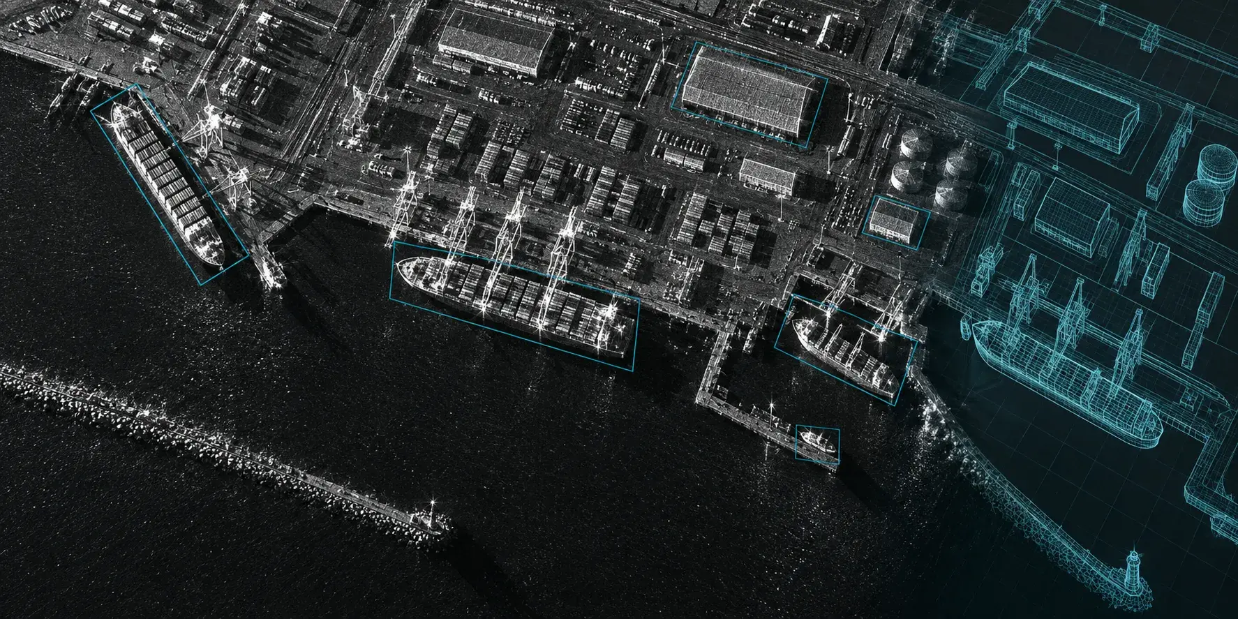
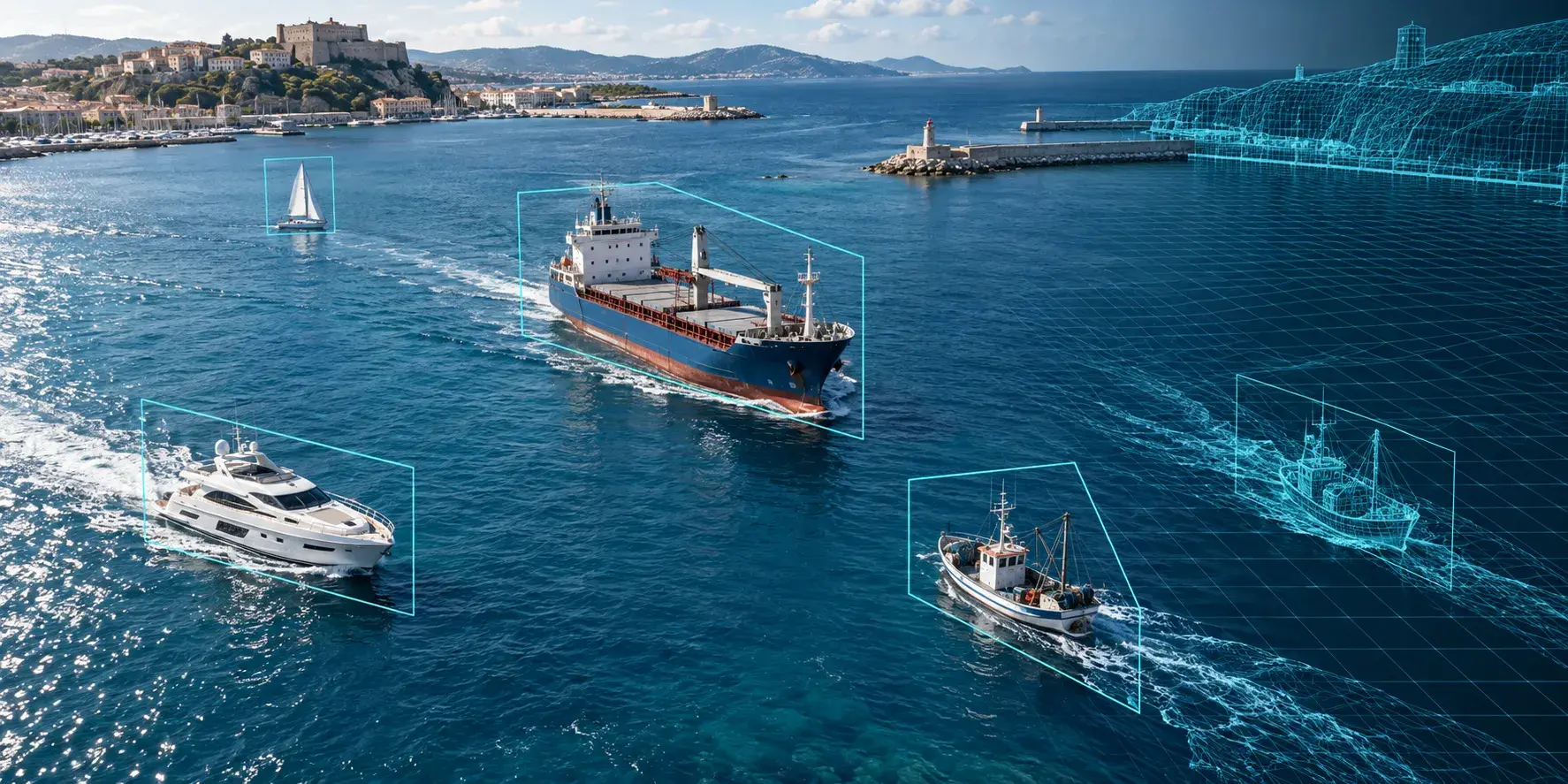
Detecting and classifying vessels in SAR imagery, separating a fishing boat from a cargo ship from open water clutter, is one of the more active application areas, partly because SAR works day or night and through cloud cover, which optical satellite imagery cannot. Synthetic scenes let teams generate specific hull types, sea states, and wake patterns that real satellite passes over a given coastline would only capture by chance.
Agriculture and border monitoring
Outside defense, synthetic SAR data supports crop and land-cover classification, where the target scenes change with the seasons faster than a fixed satellite revisit schedule can track, and border and infrastructure monitoring, where the objects of interest, a vehicle at a checkpoint, a structure along a perimeter, are rare enough in any single dataset that synthetic generation is the only practical way to get sufficient training volume.
Evaluating a Synthetic SAR Data Vendor or Pipeline
The language a vendor uses is itself a signal. Claims of perfect physical accuracy or sensor-independence are worth treating with skepticism, since the physics involved makes that a difficult promise to keep. A more useful set of questions: does the simulator model speckle noise explicitly, rather than adding generic image noise as an afterthought? Is it tuned to the specific frequency band and resolution of the sensor the model will actually run on? And has the vendor shown any validation against real measured data, ideally the kind of hybrid synthetic-plus-real training result that demonstrates the synthetic data actually holds up before a full training run, rather than a synthetic-only benchmark that never touches reality?
Scenario flexibility matters almost as much as raw realism. A fixed library of pre-rendered SAR scenes is useful if the target set is stable, but a pipeline that exposes look angle, clutter density, and target class as adjustable parameters holds up better as requirements shift, which for most programs they eventually do.
Frequently Asked Questions
What is synthetic SAR data?
Synthetic SAR data is radar imagery generated by simulating how radar waves scatter off a 3D scene and its targets, rather than captured by an actual satellite or aircraft radar pass. It is built from physics-based scattering or raytracing models and comes with automatic, pixel-accurate labels.
How accurate is synthetic SAR data compared to real measured SAR imagery?
It approximates real sensor behavior closely enough to be useful for training, but it is not a physical replica of measured radar backscatter. Most production pipelines treat it as controlled synthetic radar data that needs validation against, or blending with, real measured imagery before deployment.
Can synthetic SAR data be used to train vessel or ship detection models?
Yes, and it is one of the more common applications. Synthetic scenes can cover hull types, sea states, and wake patterns that a real satellite revisit schedule over any single coastline would only capture occasionally, which helps a detection model generalize across conditions it would otherwise rarely see.
What is the difference between simulated and measured SAR data?
Measured SAR data comes from an actual radar sensor observing a real scene. Simulated, or synthetic, SAR data is generated computationally from a 3D model of a scene and a physical scattering model. Simulated data is faster and cheaper to produce at scale and comes with perfect labels, but carries a domain gap that measured data does not.
Does synthetic SAR data need to be combined with real data for training?
In most production settings, yes. Training exclusively on synthetic SAR data can work for some target recognition tasks, but hybrid training, combining synthetic data for volume and edge-case coverage with a smaller set of real, measured images, tends to generalize better and is the more common approach in published results.